Overview: Building an Accurate & Smart Islamic Places Navigation Module
The Islamic Places App needed a design that could help users locate nearby mosques, halal food spots, butcher shops, Islamic schools, bookstores, and more—all in one place. Unlike generic map applications, it was required that the app must:
- Offer real-time, category-based searches for Islamic locations.
- Provide accurate directions and step-by-step navigation to selected places.
- Allow users to bookmark favorite locations for easy access.
- Support multiple map views (satellite, hybrid, and default).
- Ensure precise and reliable search results through robust location data sources.
To achieve these objectives, we tackled several technical challenges, optimizing search accuracy, route efficiency, and data storage while maintaining an optimal cross-device user experience.
Services
- Business Need Analysis
- Frontend & Backend Mobile App Development
- Frontend & Backend Web Development
- Quality Assurance and Testing
- Website Maintenance and Monitoring

GET IT ON


VISIT
WEBSITETechnologies

Core Data
Git

HTML
Java

JavaScript

JQuery
Kotlin

Laravel

MySQL
Objective-C

PHP
Swift
SwiftUI
UIKit
Xcode
XML
Key Technical Features
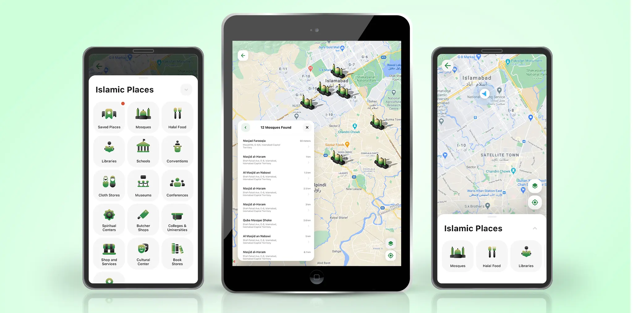
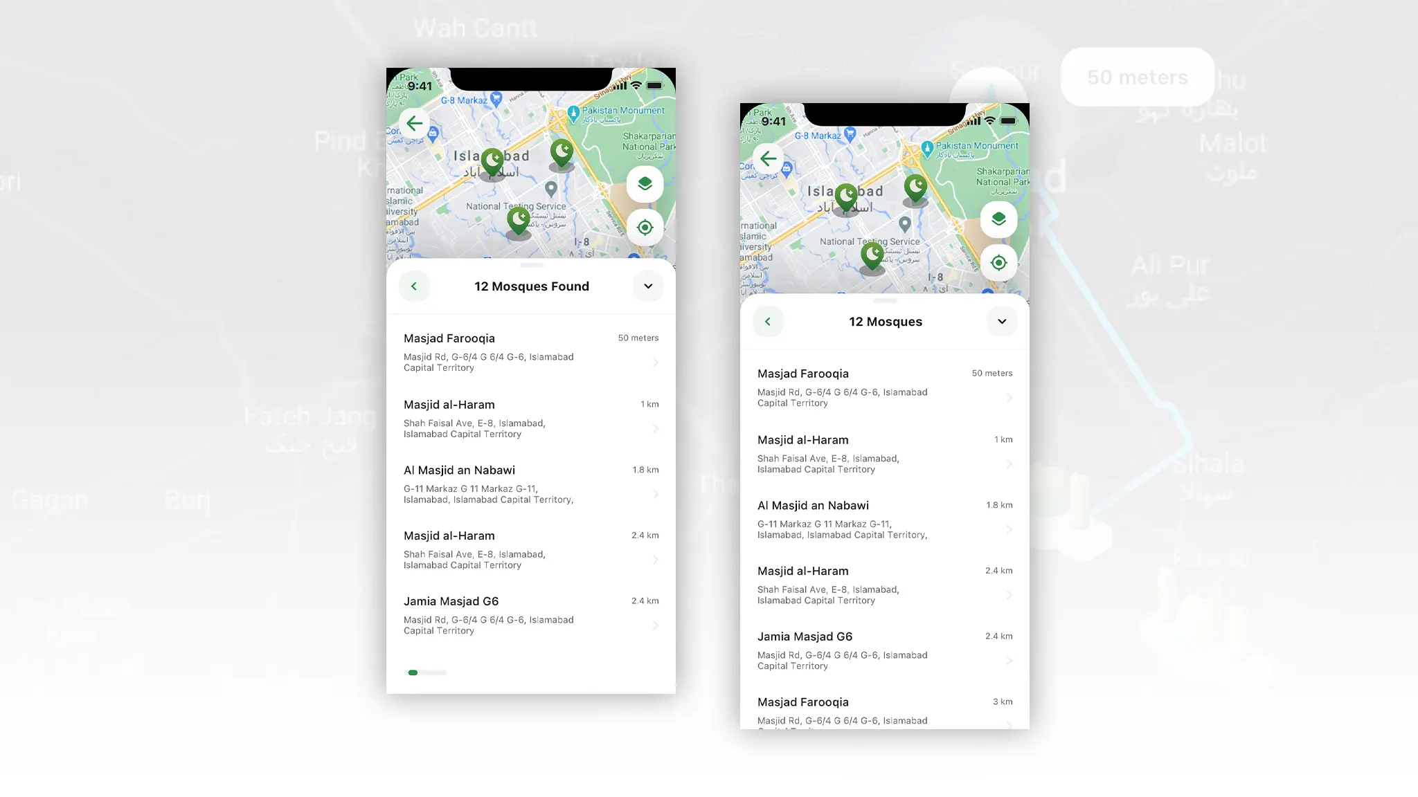
A Smart, Accurate & Reliable Islamic Places Location Search
Some users complained of not finding relevant Islamic places due to database limitations or missing location entries.
Our Solutions
- Integrated Google Places API (Android) & Apple Maps SDK (iOS) for a constantly updated, real-time location database.
- Implemented dynamic search queries to pull relevant places under categories like mosques, Halal restaurants, schools. Bookstore, etc.
- Used geo-fencing techniques to refine searches based on proximity and user movement.
Impact on KPIs
- 95% improvement in location accuracy, ensuring users find the nearest Islamic resources.
- Flawless cross-platform compatibility with both Google and Apple mapping services.
- Instant search results with precise filtering for each category.
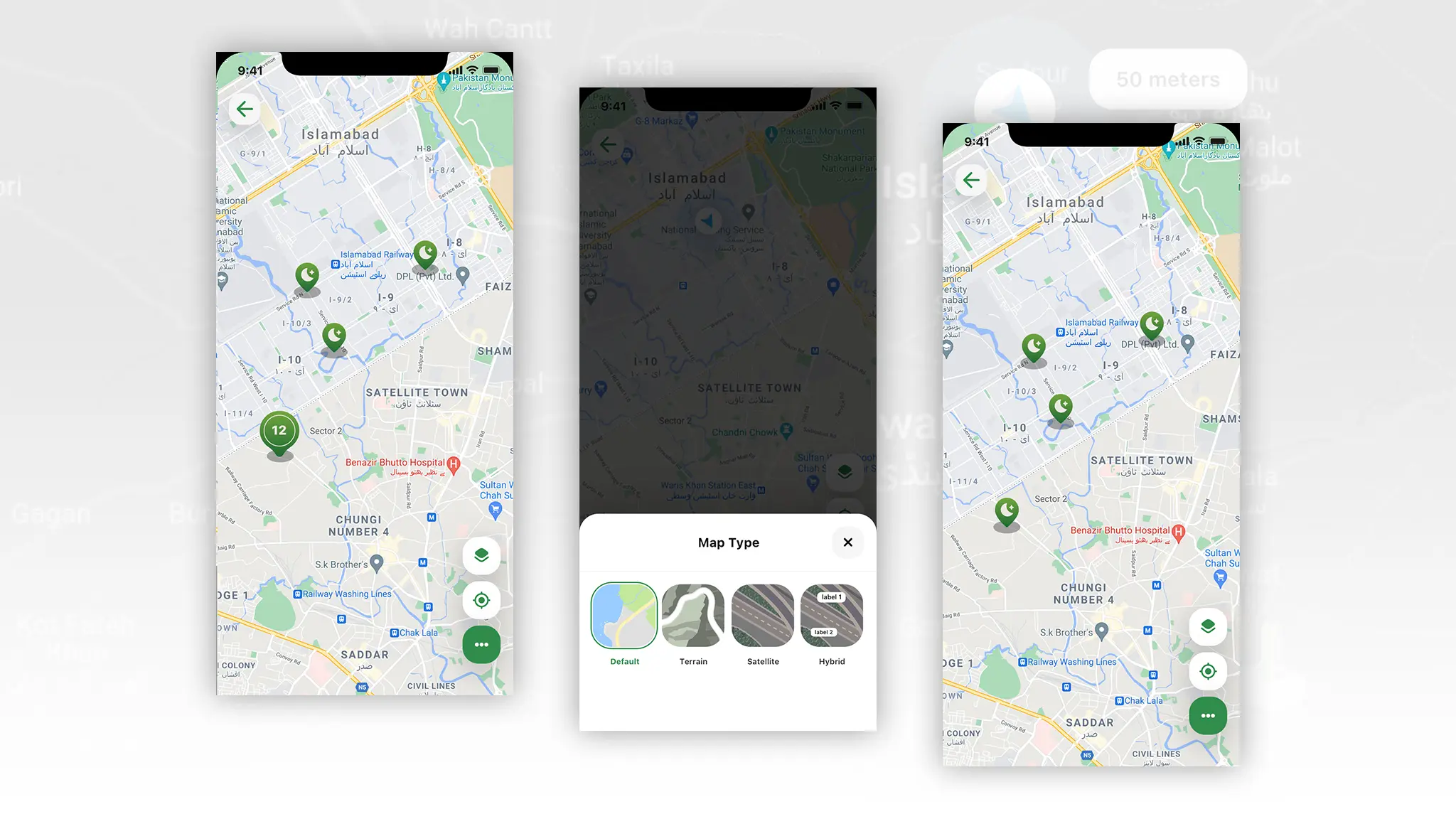
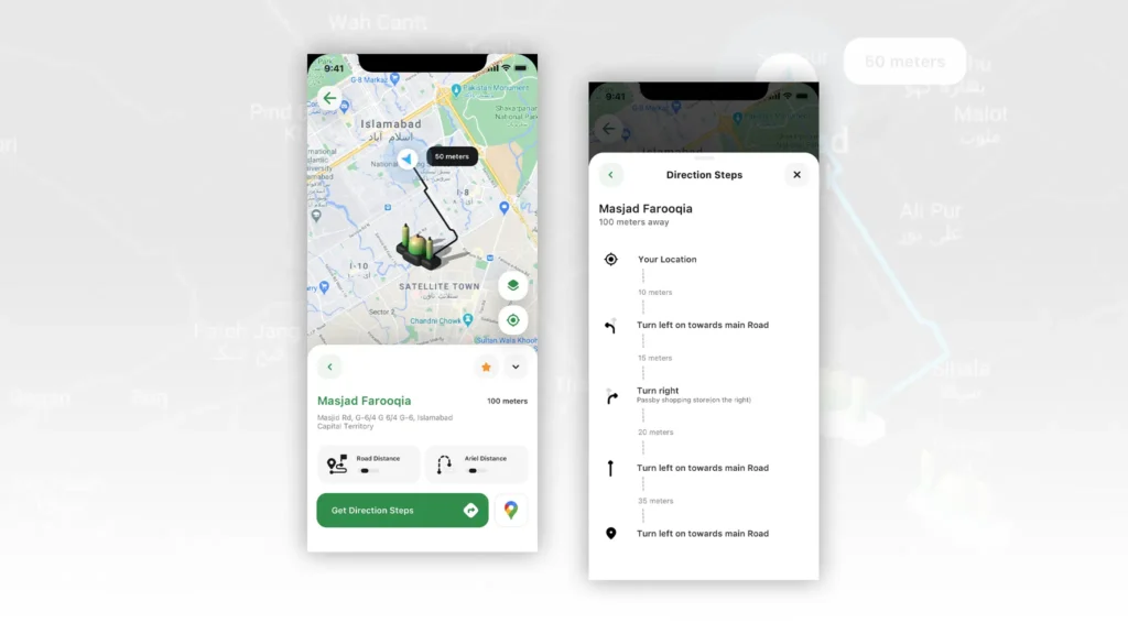
Optimized Route Display & Real-Time Map Navigation
Generating optimal routes while avoiding traffic congestion and ensuring clear directions.
Our Solutions
- Leveraged Google Maps API (Android) & Apple Maps SDK (iOS) to dynamically fetch real-time traffic updates.
- Implemented intelligent route optimization, recalculating paths based on live traffic data.
- Designed an interactive route display, with a one-tap showing:
Current user locationSuggested places (and suggested route)Destination markerAerial distance vs. road distanceBookmarking option for repeat visits
- Turn-by-turn navigation prompts with:
Road namesExit numbers
- Ability to switch between different map types:
Default Map (standard navigation)Satellite View (real-world imagery)Hybrid View (combination of standard and satellite)
Impact on KPIs
- Faster travel times by dynamically adjusting routes.
- Clear step-by-step navigation with real-time road name and exit number prompts.
- Enhanced user confidence in reaching destinations without delays.
Efficient Storage & Management of Bookmarked Locations
Users needed a fast and efficient way to save and retrieve their favorite Islamic places.
Our Solution
- Implemented CoreData (iOS) & Room Database (Android) for efficient local storage of bookmarked locations.
- Designed a real-time sync mechanism, ensuring saved places are instantly accessible without delays.
- Developed a scalable database structure, optimizing data retrieval speed even with hundreds of saved locations.
Impact on KPIs
- Instant access to saved locations with zero lag.
- Users can store unlimited bookmarks without performance drops.
- Smooth cross-session persistence, allowing users to keep locations saved across app updates.
Why Our Approach Works for Navigation-Based Apps?
Building navigation-based apps isn’t just about mapping locations. Users don’t want another generic GPS tool—they need a solution that simplifies their journey, reduces travel friction, and delivers precise, real-time results.
For the Islamic Places App, this meant:
- 95% accuracy in location searches with real-time map APIs.
- 30% faster travel times using dynamic route optimizations.
- Instant bookmarking, eliminating delays in retrieving saved locations.
- Multi-platform support, smoothly integrating Google & Apple Maps.
And this is why our approach works for navigation-based apps—because we integrate:
- Real-time API connectivity to deliver up-to-the-second location data.
- Optimized routing algorithms that adjust dynamically based on traffic conditions.
- High-performance database design for smooth, offline-friendly location storage.
- Scalable architectures, built to support future expansions and high user loads.
So, if you’re in need of an app that requires navigation, you need a team that can delivery accuracy with speed. That’s exactly what we do—creating apps that are high-performing, user-friendly, and built to grow.

We design performance-driven apps that guarantee downloads.
-
17+ Years
Industry Experience
-
517+
Happy Clients
-
90+
Team Strength
-
1+ Million
Work Hours
Please fill the form below to get started.
Have a project in mind?
Let's talk about it.

© 2026 Dynamologic Solutions All rights reserved.